Reference
How Tall Is Mount Teide? 3,715 m, and Why Sources Disagree
The summit of Mount Teide stands at 3,715 metres above sea level. That is the surveyed figure in current use, and it makes Teide the highest point in Spain by a clear margin. But look at an older map, a sign that has been up for decades, or certain guidebooks still in circulation, and you will find 3,718 metres — an extra three metres that the mountain no longer officially claims.
The discrepancy is small, but it is persistent, and it is worth understanding because it touches on how a volcano of this kind gets measured in the first place.
Where the 3,715 m figure comes from
The modern elevation of 3,715 m (12,188 ft) is the result of GNSS-based surveys — the same satellite positioning technology used for mapping and navigation, applied at the summit with sufficient precision to settle a long-running ambiguity. The Instituto Geográfico Nacional (IGN), which maintains Spain’s official geodetic data, recognises 3,715 m as the current height.
The older figure of 3,718 m was established by earlier survey methods, likely using barometric altimetry or optical levelling from a different reference point. Those methods carry more uncertainty than satellite geodesy, and the difference of three metres falls within the margin of error you would expect from 20th-century surveying on a steep volcanic cone. The older number was never wrong in its time; it is simply no longer the best available measurement.
Some signs in the national park and on older printed material still show 3,718 m. That is not an error — it is an artefact of a slow update cycle. The official figure changed, but not every physical marker got replaced.
What 3,715 m actually means
The altitude is measured from mean sea level, which for Teide is referenced to the tide gauge at Santa Cruz de Tenerife. That is the standard convention for elevations worldwide: height above the nearest sea surface, not height above the ground directly beneath the peak. For a mountain that rises from a coastline, this is straightforward. For Teide, it is worth noting because the sea-level reference gives a number that understates the true vertical scale of the volcanic edifice.
From its base on the ocean floor, the Teide–Pico Viejo complex rises roughly 7,500 m. The seafloor around Tenerife sits well below the surface, and the summit reaches 3,715 m above it. That cumulative vertical relief — base to peak — makes Teide one of the tallest volcanic structures on Earth by that measure. Exactly where it ranks depends on the comparison set and the method: whether you count from the deepest point of the local seafloor or from the average depth of the surrounding abyssal plain, and whether you compare only subaerial volcanoes or include seamounts. The point is the scale, not a rank number.
For context, mainland Spain’s highest summit, Mulhacén in the Sierra Nevada, stands at 3,479 m. The highest Spanish summit in the Pyrenees, Aneto, is 3,404 m. Teide exceeds both by a clear margin. It also sits well above the highest peak in any other Atlantic island group, from the Azores to the South Atlantic.
A mountain that changes
Volcanoes are not static. Teide is an active stratovolcano — dormant, not extinct — and its summit elevation can shift over geological time through eruptions, collapses and erosion. The 1798 flank eruption at Narices del Teide did not alter the summit cone itself, but the mountain’s overall shape has been modified repeatedly by events such as the giant landslide that removed the island’s north flank roughly 180,000 years ago, forming the Icod valley. In the longer view, the summit height is a temporary number.
That said, no modern survey has detected any measurable change in the summit elevation since the current figure was established. The 2004 seismic crisis — a swarm of small earthquakes beneath the island — raised questions about deep magma movement but produced no surface deformation that would affect the summit height. The monitoring networks run by INVOLCAN and IGN track ground deformation continuously. If the summit changes, the survey will catch it.
The cable car’s altitude
The upper station of the Teide cable car, La Rambleta, sits at 3,555 m. That leaves 160 vertical metres between the station and the summit — roughly the height of a tall building. The base station is at 2,356 m, so the ride gains 1,199 m in about eight minutes.
The final stretch from La Rambleta to the summit is Trail 10, the Telesforo Bravo path. It requires a free but strictly limited permit, with about 300 places per day. The trail is steep and exposed, and the hiking guide covers how long to allow for it. The altitude at the upper station is already high enough to affect some people; the extra 160 m can be felt in the thinner air.
The cable car itself does not reach the summit, and never has. The gap is deliberate — it preserves the summit cone from uncontrolled foot traffic and keeps the permit system meaningful.
Why the number matters
The 3,715 m figure is not an abstract data point. It determines where Teide sits in the geography of Spain and the Atlantic, and it shapes the experience of being on the mountain. The altitude is high enough that there is measurably less oxygen in each breath than at sea level. That is comparable to the physiological stress of being on a high peak in the Alps or the Andes, and it is the reason the permit system exists — not just to limit numbers, but to ensure that everyone attempting the summit has passed through the acclimatisation checkpoint at La Rambleta.
The height also governs the climate. The summit cone is above the trade-wind inversion layer most of the year, which means clear skies, intense UV and temperatures that can drop below freezing in any month. The snow that sometimes caps the peak in winter is not a weather event — it is the direct consequence of 3,715 m of elevation in the mid-Atlantic.
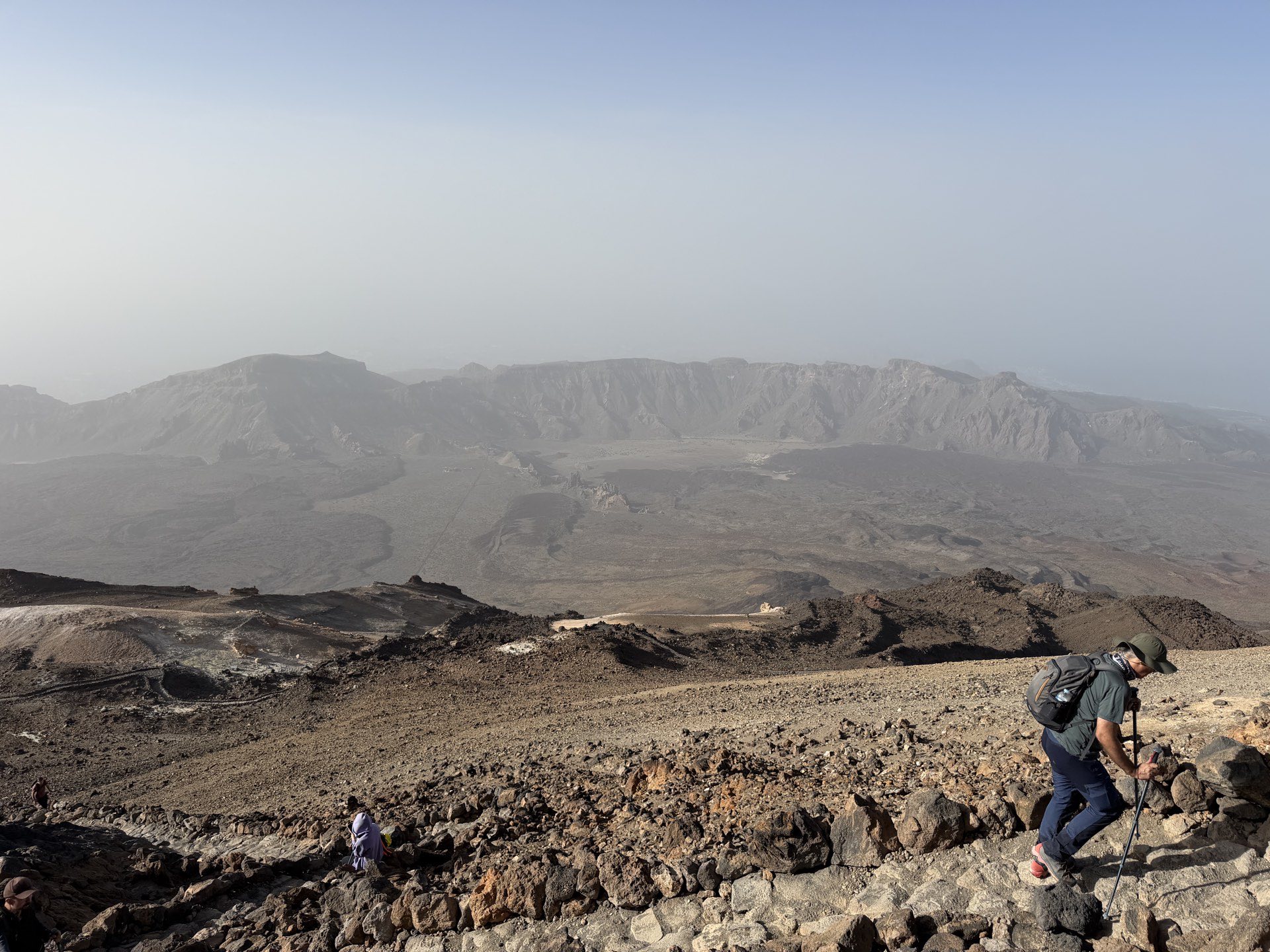
For the visitor standing at La Rambleta, the difference between 3,718 and 3,715 is invisible. The view is the same: the caldera wall dropping away to the south, the island of Gran Canaria on the horizon, the shadow of the mountain projected across the sea at sunset. The number matters only when you are comparing it to something else — another peak, an old map, a record book.
The Guanche perspective
Before any surveyor set foot on the summit, the Guanches called the mountain Echeyde, a name linked to the underworld. Their cosmology placed the malign spirit Guayota inside the mountain, and the pale summit cone was explained as the plug that the sky god Achamán set in place after defeating Guayota. The height was not measured, but it was understood as a boundary between the human world and the realm beneath.
The name Teide is almost certainly a Spanish adaptation of Echeyde, though competing derivations exist. What is clear is that the mountain’s vertical scale was central to its sacred geography long before anyone thought to quantify it.
The practical takeaway
If you see a source quoting 3,718 m, you are looking at an older measurement. The current official figure is 3,715 m. Both numbers refer to the same physical summit, and the three-metre difference is well within the margin of error of the older survey methods. There is no dispute among the relevant authorities — the modern survey is accepted, and the older figure is simply out of date.
For planning a visit, the number that matters is not the summit elevation but the altitude at which you will be active. The cable car drops you at 3,555 m. The Altavista refuge, which reopened in July 2026 after renovation, sits at 3,260 m. The walking ascent via Montaña Blanca starts from the TF-21, a little below the cable car base station. Each of those altitudes has its own implications for pacing, hydration and awareness of altitude symptoms. The summit figure is a fact; the practical altitudes are the ones to plan around.
Teide is 3,715 m above the sea, and about 7,500 m above the seafloor. It is the highest point in Spain, the highest in the Atlantic islands, and one of the tallest volcanic structures on the planet by base-to-peak measurement. The three metres that older sources add are a reminder that measurements have histories, and that a number on a sign is only as current as the survey that produced it.